




Carrington Falls
Current trail weather
8° Partly cloudy
- Today 10° 6° 47%
- Mon 14° 7°
- Tue 14° 8°
- Wed 11° 5° 20%
- Thu 12° 7° 35%
Details


Carrington Falls Walk, Budderoo National Park
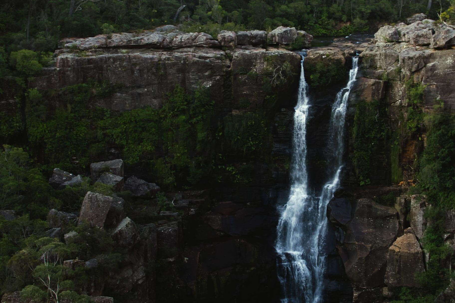
Carrington Falls is one of the most impressive waterfalls in the Southern Highlands, located in Budderoo National Park near Robertson. The short Carrington Falls walking track is a scenic 0.6 km loop that takes around 30 to 45 minutes to complete, making it a great stop for families, photographers and visitors looking for an easy waterfall walk near Robertson.
The walk starts from Carrington Falls picnic area, also known as Thomas’ Place picnic area. From here, the track follows the edge of the escarpment and links several lookout points with excellent views of Carrington Falls and the surrounding Kangaroo River valley. The waterfall drops dramatically into the gorge below, with the lookouts offering some of the best views of the falls without needing to walk far from the car park.
Getting to Carrington Falls
Carrington Falls is located in the Carrington Falls area of Budderoo National Park, around 7.5 km from Robertson. From Robertson, head east on the Illawarra Highway, turn onto Jamberoo Mountain Road near the Robertson Pie Shop, then follow the signs to Carrington Falls Road and Thomas Place Road. Parking is available at Carrington Falls picnic area, where the walking track begins.
The road access is suitable for 2WD vehicles, although conditions can change after heavy rain or during poor weather. Always check current park alerts before visiting.
Walking the Carrington Falls loop
The Carrington Falls walking track is short but rewarding. From the picnic area, the loop leads to several lookouts with different perspectives of the waterfall, gorge and surrounding bushland. Falls View lookout offers a classic view of Carrington Falls, while other lookouts along the track give you a better sense of the escarpment and the depth of the valley below.
Although the walk is relatively short, it is graded as a Grade 3 track and includes many steps, formed paths and some short steep sections. Take care around cliff edges, stay behind safety barriers and keep to the marked track at all times. The area can become slippery after rain, so sturdy walking shoes are recommended.
Carrington Falls picnic area
Carrington Falls picnic area is a pleasant place to stop before or after the walk. Facilities include picnic tables, parking and non-flush toilets. Visitors should bring their own drinking water and take all rubbish with them, as bins are not provided.
The picnic area is also a good base for exploring other nearby walks in Budderoo National Park, including Izzards lookout track, Nellies Glen, Warris Chair lookout track and Missingham lookout track.
Nearby walks and lookouts
If you have extra time, there are several other short walks and lookouts close to Carrington Falls. Nellies Glen is located on the other side of the falls and offers access to a scenic waterhole. Warris Chair lookout and Missingham lookout provide longer walking options with views across Carrington Falls Gorge and the surrounding escarpment.
For experienced walkers interested in learning more about the lower section of Carrington Falls, read our separate guide to the base of Carrington Falls before planning your visit. This is not part of the official short walking track and should only be considered by walkers with the right skills, preparation and conditions.
Carrington Falls is one of the best short waterfall walks in the Southern Highlands. With easy road access from Robertson, dramatic lookout views, picnic facilities and nearby walking tracks, it is a great stop for anyone exploring Budderoo National Park, Jamberoo Mountain Road or the Robertson area.
If you are interested in getting to the bottom of Carrington falls we can assist. Follow the link for our guide on getting to the bottom here.
- Track distance
- 2.3 km
- Ascent
- 255 m
- Steepness
- Very steep (110.9 m/km)
- Descent
- 255 m
- Elevation range
- 439–586 m
Map data: © OpenStreetMap contributors, SRTM | Map style: © OpenTopoMap (CC-BY-SA) · MapLibre GL JS
Elevation profile
Sign in to share recent conditions, contribute a photo, or upload a GPX/GeoJSON route.




Hi there,
I was reading your article on about how to get to the bottom of carrington falls. I’ve been hiking just over a year and gained some experience in paths somewhat similar to the carrington falls one. It also stated in your article that you can take us there. I was hoping is it still possible to take me there, if not could you give us a detailed walkthrough on how to get there.
Hope to hear from you soon.
Thanks
Hi Arvind,
I know we’ve already reached back out to you but just so other people are aware. We’re currently unavailable to personally show anyone down there for a few months as we are expecting our first child soon so are avoiding areas with limited service.
To summarise your questions you asked during our chat, you don’t need any equipment for climbing around/over the boulders but you may get your feet wet depending on what path you find.