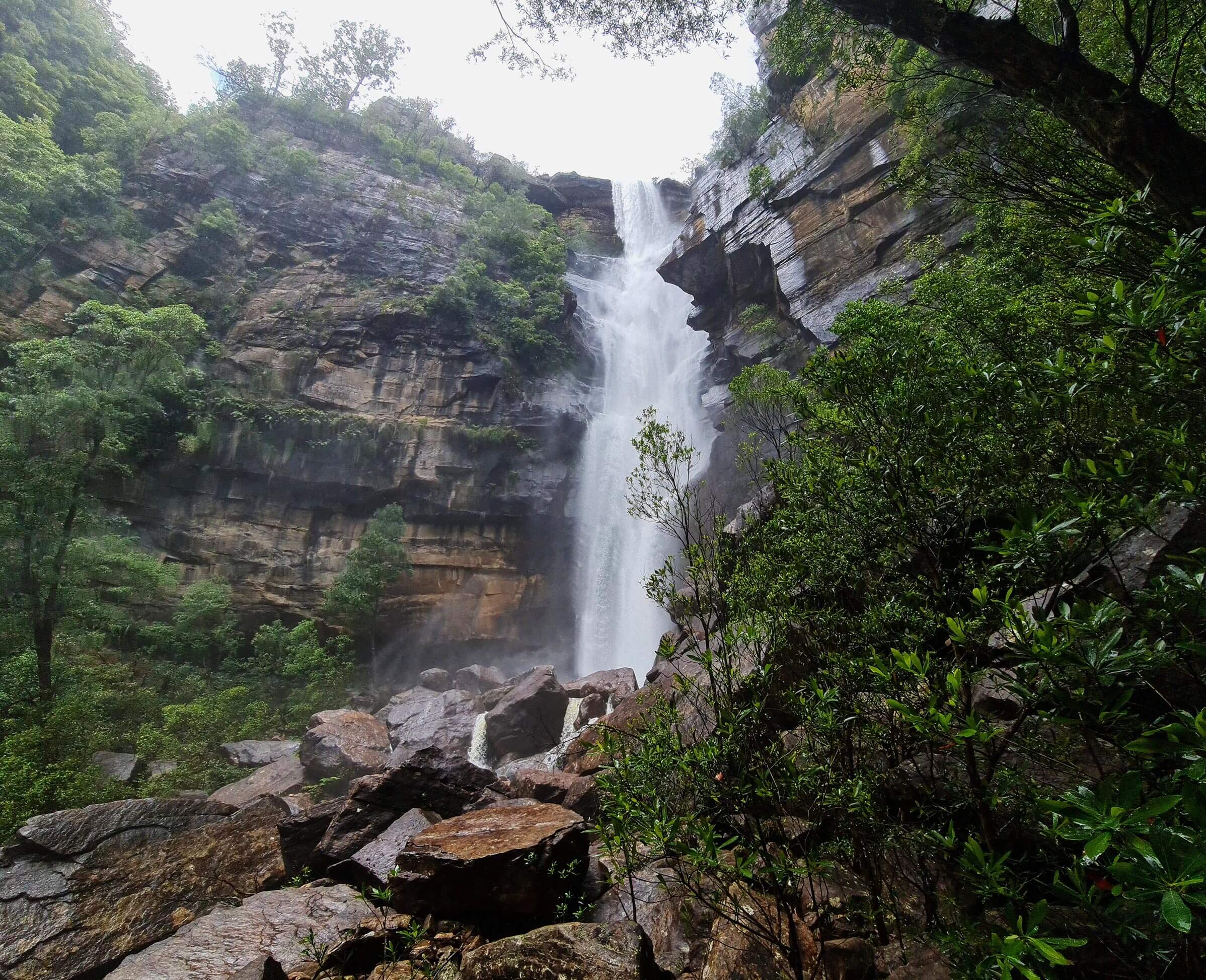
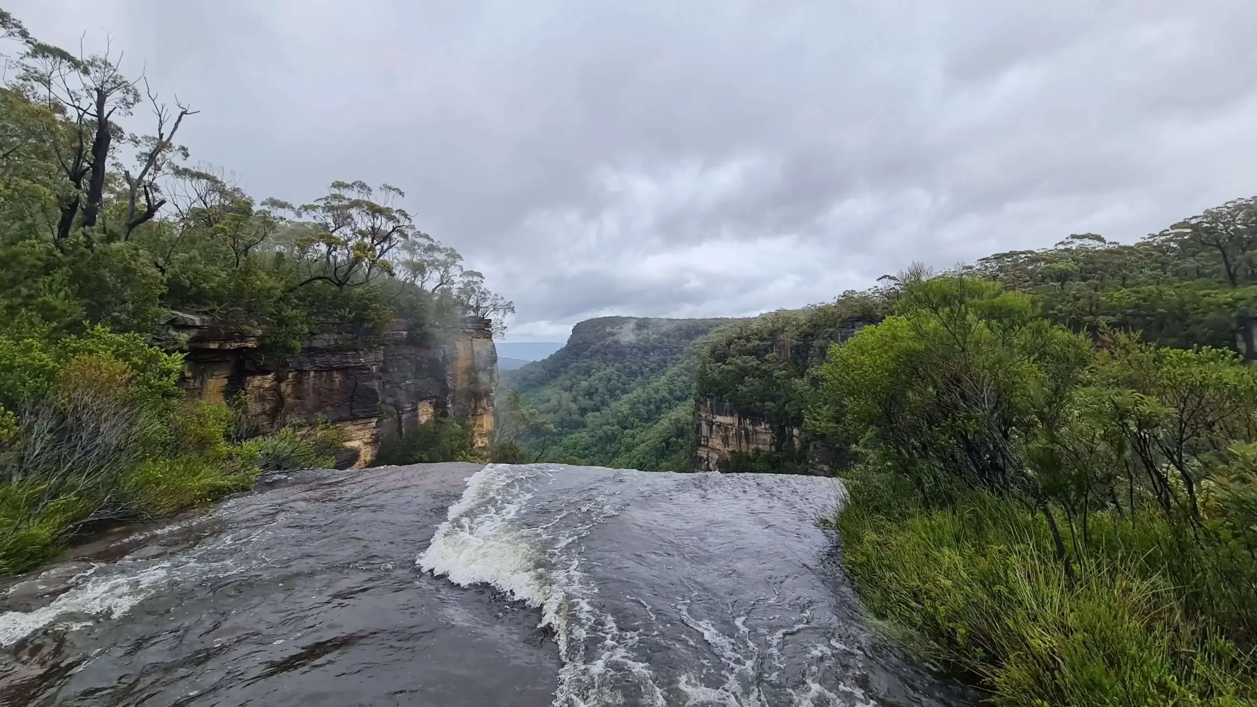
The bottom of Gerringong falls
Current trail weather
11° Overcast
- Today 13° 7° 1%
- Wed 11° 5° 2%
- Thu 12° 7° 72%
- Fri 11° 5° 78%
- Sat 12° 5° 31%
Details
Gerringong Falls, is a spot you have undoubtedly seen on socials and been in awe of. Its square-cut pool with a waterfall neatly tucked into its corner makes it one of the most sought swimming/hiking locations in Australia. However, the hike to the bottom where the pool is located is not for inexperienced hikers. It is steep, requires a climb and due to its rainforest location, is very slippery.
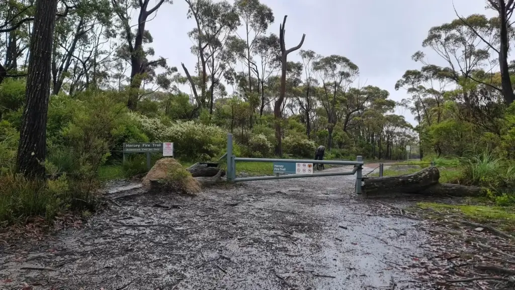
Gerringong Falls trailhead
The trailhead starts on the fire trail Budderoo Plateau Rd off Jamberoo Mountain Rd, found here. Where you can park your car, if there is no parking here you can follow the fire trail further in, to a locked gate.
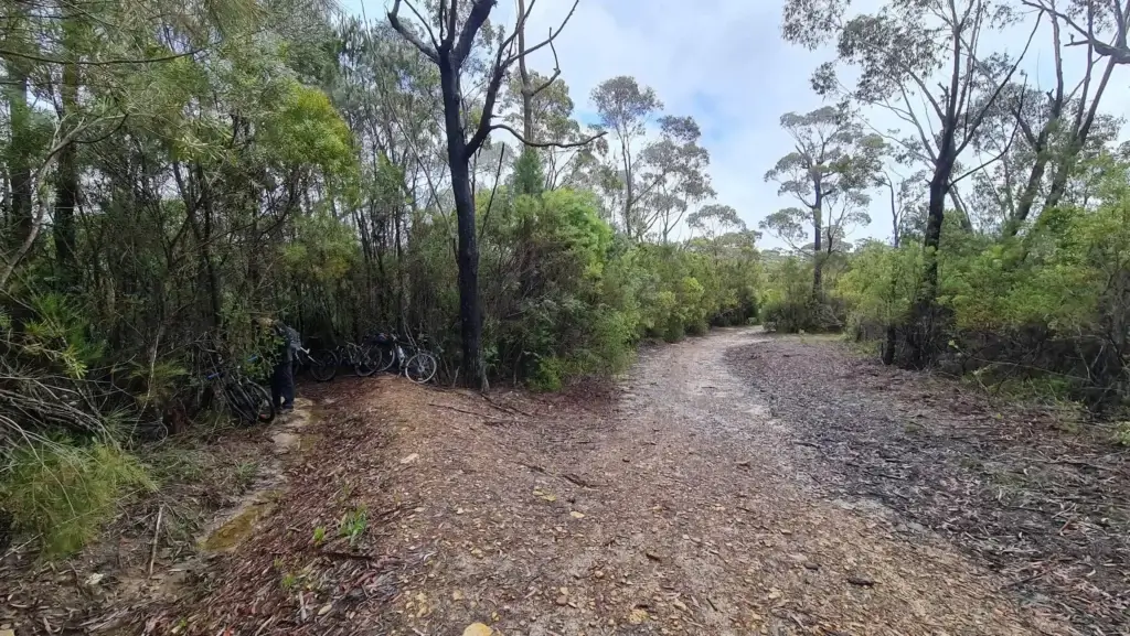
There are two ways most people undertake this journey, most people choose to ride a mountain bike for the fire trail to the top of Gerringong Falls. At the same time, there is always the option of hiking it. We strongly suggest the cycling option, as the fire trail is very long and biking will let you get the most out of your time at the falls.
The ride from Jambaroo Mountain Road to the top of the falls is 8.5km of fire trail. From there you can either walk to the Gerringong Falls lookout or start the descent to the bottom of Gerringong Falls.
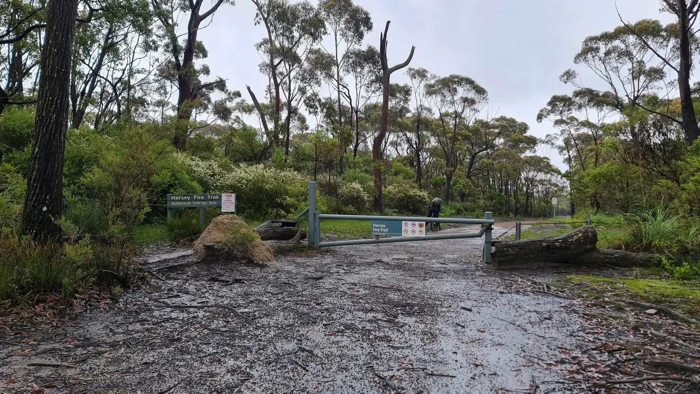
Guide to the top

The first leg of the hike/ride is from the trailhead to the Hersey Fire trail. This leg of the trip is 6.2km. You will then follow Hersey Firetrail for 2.3km. If you follow the track to the very end, you will reach Gerringong Creek, which you will need to cross to the lookout. Once over the creek, follow the trail through the thick scrub and follow the track and take the path to the left. If you keep following this track rather than turning left, you will end up back on Budderoo Plateau Road.
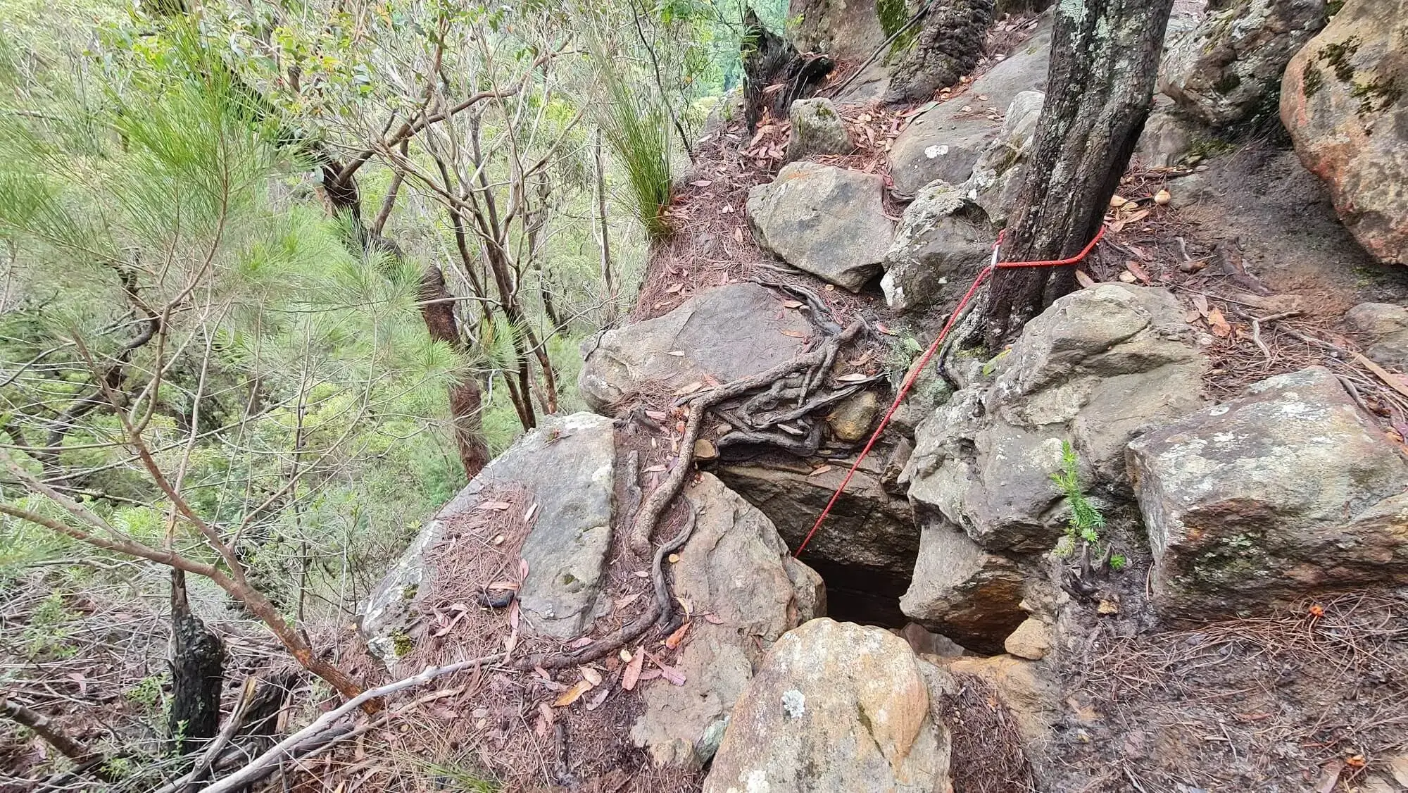
Starting the descent to the bottom
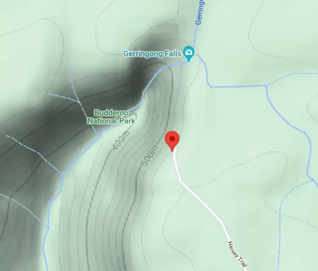
Along the Hersey Fire trail, you will come to a gutter to the left (pictured below). This is we you will enter the bush to start the hike to the bottom. The track here is clearly warn in. The trail from here to the bottom of the falls is roughly 1km.
The below map marker is the approximate location for the above image.
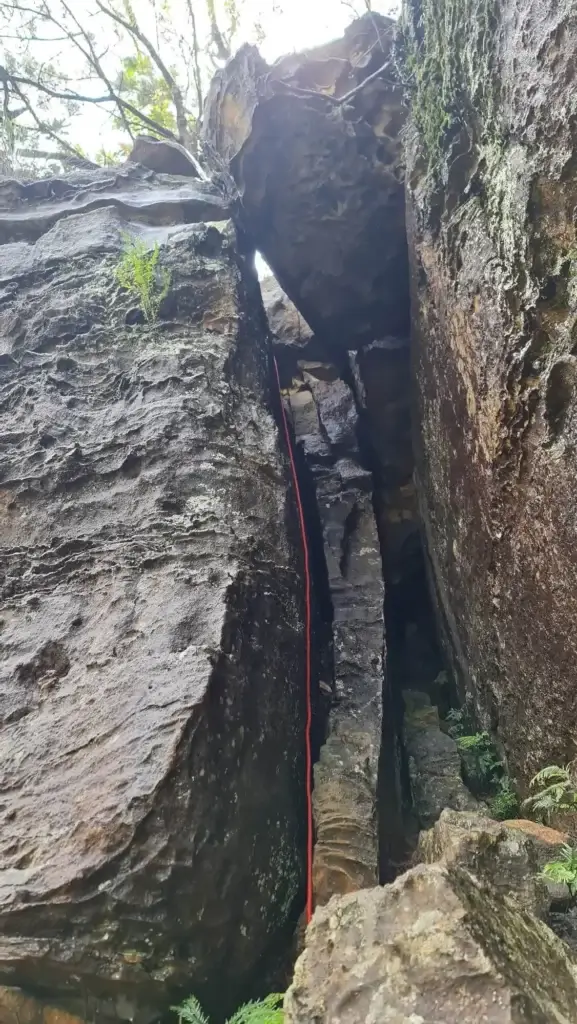
The Chimney
While following the trail, you will encounter a lot of arrow markings painted on various rocks and trees. These will lead you to the most difficult part of the hike to the bottom of Gerring Falls. The Chimney, a vertical slot in the rock face, resembling, you guessed it, a chimney. Pictured below, you will need to climb down this slot. We highly recommend you take along some rope of at least 5 metres in length. This will enable you to lower your packs down separately from your climb. The rope if securely fastened to a tree at the top, can also be used to assist your descent. If you leave it in place, you can you it on your way back out too.
An added measure of safety for the short climb, as well as a rope, and a climbing helmet, would be well welcomed.

From here, you will follow the warn-in trail, again well-marked with painted arrows. The trail to the bottom of the falls is mostly huge the bottom of the cliff. You at no point need to go down to the river to get to the falls. As there is a rouge arrow that can be misinterpreted as needing to follow the river, I figure that I should point that out. The Hike to the falls from this point is relatively simple.
If you do choose to go down to the river you will be in for some of the most tranquil experiences.
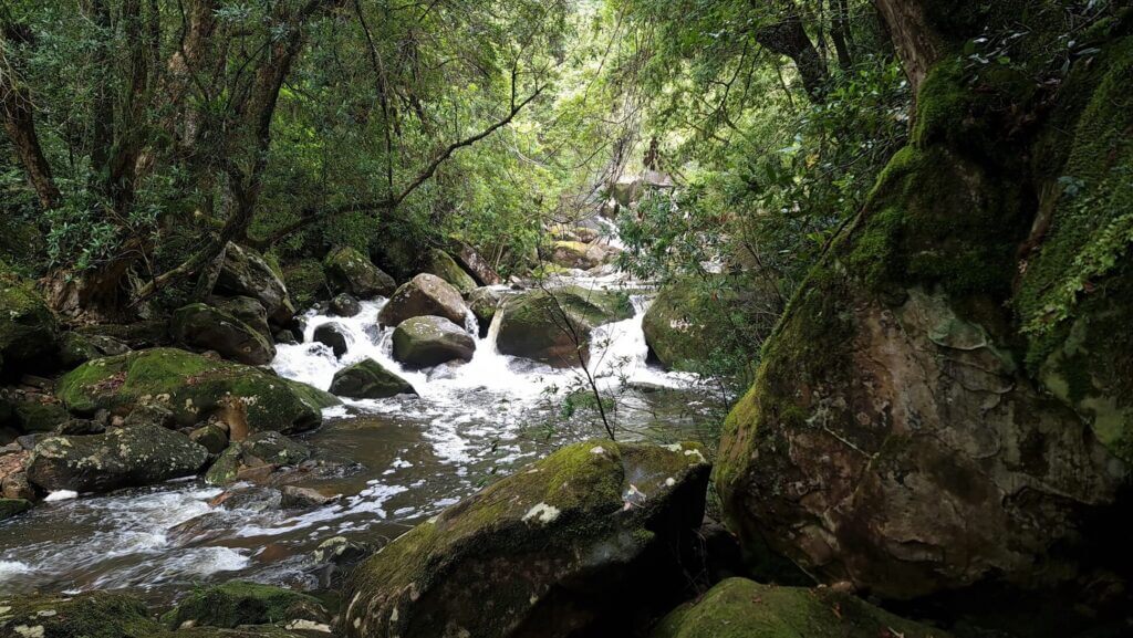
When you reach the bottom of Gerringong Falls, you will be greeted with the most surreal natural swimming hole the region has to offer.
- Track distance
- 18.27 km
- Ascent
- 624 m
- Steepness
- Moderate (34.2 m/km)
- Descent
- 624 m
- Elevation range
- 534–658 m
Map data: © OpenStreetMap contributors, SRTM | Map style: © OpenTopoMap (CC-BY-SA) · MapLibre GL JS
Elevation profile
Sign in to share recent conditions, contribute a photo, or upload a GPX/GeoJSON route.


Walk reviews
No reviews yet.
Sign in to leave a review for this walk.
Recent reviews
No written reviews yet. Be the first to share your experience.