
Gunrock Creek Falls
Current trail weather
3° Clear sky
- Today 12° 4° 2%
- Fri 11° 1°
- Sat 14° 3°
- Sun 14° 4°
- Mon 14° 3° 2%
Details
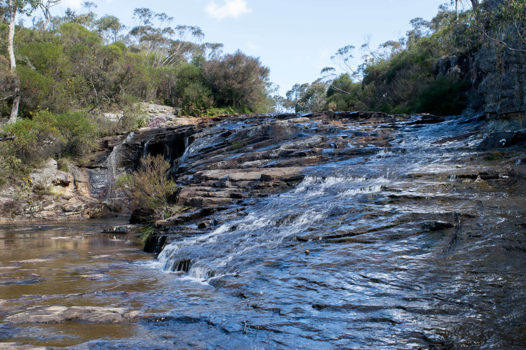
Gunrock creek falls located on Meryla road in the Southern Highlands is a speculated swimming hole with spectacular vistas of the waterfall and surrounding escarpment. Gunrock creek falls are found 1km up the gunrock creek fire trail, you can drive right to the top of the falls if you have a 4wd and have at least intimidate skills in off-road 4wding as some technical driving is required on the track in on the fire trail. If you don’t have access to a 4wd you can always park in a nearby clearing of the trail head and go in on foot, just keep in mind other cars that may use Mmaryla road when parking as it is a narrow unsealed road. Also keep in mind that you don’t block any 4wd access trails as the area is very popular with 4 wheel drivers.
Finding the trail head
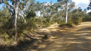
The start of the trail is not marked but is marked on the map below, it will be on your left going down Meryla road 250m after the second bridge you cross. The trail head is a rough 4wd track pictured just below.
Navigating the trail
The trail is relatively easy to navigate, follow the trail until you come to a Y in the road 525m into the track, at the Y take the road to the left. follow this road until you reach an opening where a few different tracks all split at 550m into the trail. From here you can either tack any of the track to your slight right that take you to a river crossing, this river leads to the top of the falls.
Proceed with caution getting to the top of the falls as you will need to walk through the shallow water down the falls which pose a high risk of slipping. Alternatively, you can go down to the bottom of the falls where there is a larger swimming hole and a better view of the Gunrock creek falls, the trail head for getting to the bottom is found to your left just before you get into the open area where the tracks split.
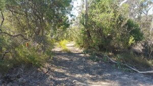
To your left(as pictured just below) is a fairly overgrown 4wd trail, follow this for 50m where it will come to and end and you can then climb down the rocks, there should be some orange ribbons(keep in mind that the ribbons may have been removed by the time you undertake this bush walk). The walk down goes for roughly another 50 meters and brings you out at the base of the falls.
Note
There are no facilities near by so make sure you take everything that you need with you, including plenty of water and food, take everything with you leaving nothing but foot prints.
- Track distance
- 2.46 km
- Ascent
- 99 m
- Steepness
- Moderate (40.2 m/km)
- Descent
- 99 m
- Elevation range
- 590–626 m
Map data: © OpenStreetMap contributors, SRTM | Map style: © OpenTopoMap (CC-BY-SA) · MapLibre GL JS
Elevation profile
Sign in to share recent conditions, contribute a photo, or upload a GPX/GeoJSON route.


Walk reviews
No reviews yet.
Sign in to leave a review for this walk.
Recent reviews
No written reviews yet. Be the first to share your experience.