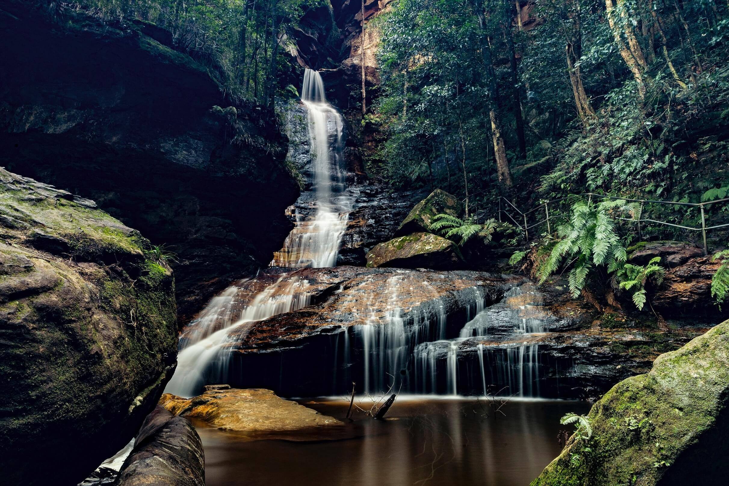
Empress Falls
Current trail weather
-0° Clear sky
- Today 10° -2°
- Sat 14° -2°
- Sun 14° 2° 4%
- Mon 15° 1° 3%
- Tue 12° 1°
Details
Empress Falls Overview:
Empress Falls is found in the Blue Mountains just outside of Wentworth Falls, as part of the Blue Mountains National Park. These falls are an extremely popular location, mostly due to the impressive waterfalls along this track, in addition to being a popular destination for canyoners and tour groups alike. The walk to these falls is moderate as there are steep steps on the return which some walkers may find difficult. It is important to pack sunscreen, water, a jumper and a hat for this walk. If you are a canyoner, this spot has plenty of great spots before reaching the final descent down the falls. The walk is roughly 1.1 km return and takes just over an hour to complete. There are other tracks that continue on/link to other walks if you decide to continue on.
Starting The Walk To Empress Falls
The walk to Empress Falls begins from the conservation hut (cafe) that is found beside the small car park. We do recommend starting the walk early in the morning to avoid the crowds and find parking. This is a great place to stop for lunch on the way back if you can find a seat, otherwise, pack a nice picnic and plenty of water to have at the bottom.
google_ad
The walk follows the ‘Valley of the Waters’ sign down the timber and dirt steps for most of the way. There are sections of the walk that will bring you to cross sections but you continue following the signs for “The calley of the waters”. The track soon leads to the signposted intersection with the ‘Short Cut Track’ where you will continue straight. Along the path down you will notice that there are smaller paths leading you into the bush, these just take you to some little picnic spots, but sticking to the main path will lead you to the falls.
Further down the track you will approach a 3 way intersection (signposted ‘Overcliff Track’ and ‘National Pass’). You will continue straight from here, continuing on the ‘Valley of the Waters’ track. You will notice some smaller tracks at this point leading to the bush or openings of some of the views. They are not official tracks and do take you to unfenced lookouts where you are at risk of falling so be careful if you do decide to check them out along the way.
The walk continues on down some steps, soon coming to an unsignposted intersection with the Lyrebird Cliff track (on a small sandstone rock platform). You will follow this straight where you will shortly see a another sign with ‘Queen Victoria Lookout’ track. Here you have the option to turn left to view the lookout which will only add an extra minute to the walk on an easy track and well worth it. If you are just in a rush to get to the falls, continue on the main pass until you reach a sign that says ‘Empress Lookout’.
Empress lookout will offer you a view of above the falls where you can watch others abseil down. This is a great spot to get some long-distance photos of the falls and the views of the valley below. From there you continue along the track and will start to descend down a metal staircase which is fairly steep. You will then follow the path along before reaching some more stairs where there will shortly be another intersection. with the ‘Nature Track’ and a sign pointing back to ‘National Pass – Tea Rooms’. From the intersection, this walk follows the ‘National Pass – Valley of the Waters’ sign.
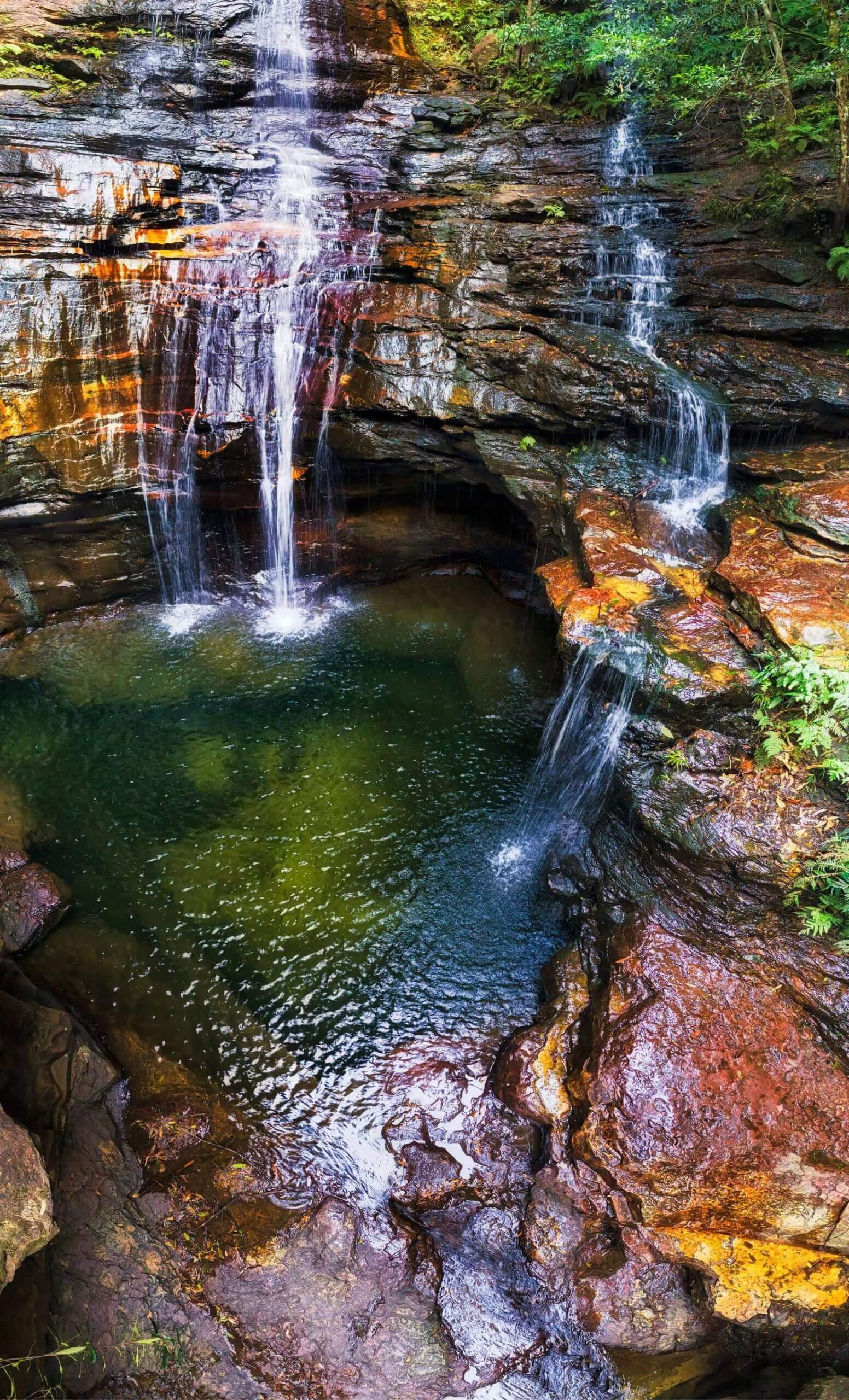
From here, you are nearly at the falls. The walk continues down some more steps before reaching a creek called ‘Isabel Creek’. To cross here, you will need to use the stepping stones. You will then need to travel down one last set of stairs before reaching your final set of stepping stones to cross the Valley of Waters Creek that is in front of Empress Falls.
Continuing To Lodore Falls & Sylvia Falls:
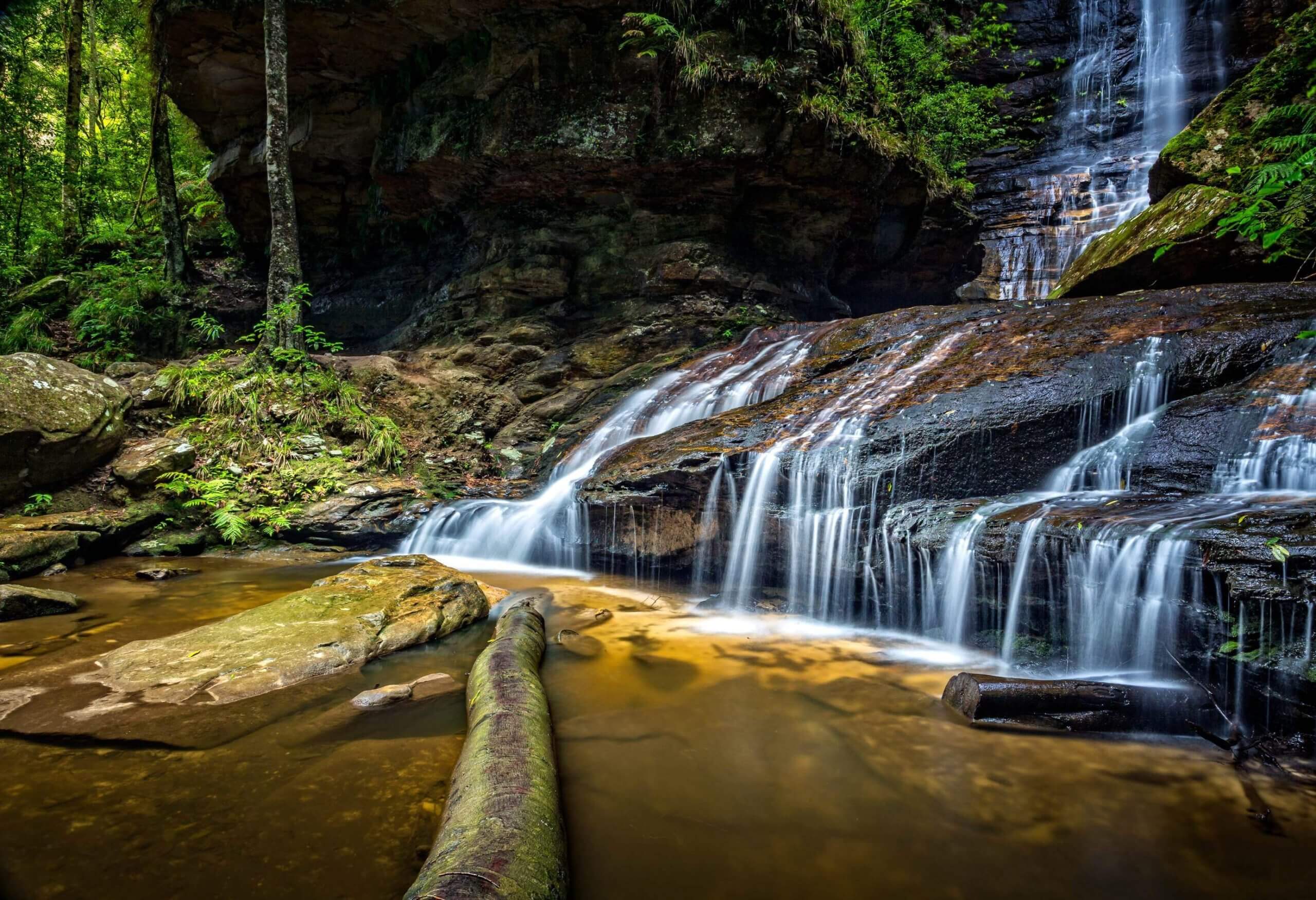
If you haven’t had enough of your waterfall fix from Empress Falls, you can continue on a short side trip to Lodore Falls and Sylvia Falls. This section of the walk isn’t as popular and does require a little more fitness to complete this walk. From in front of Empress Falls, you continue straight, this walk heads downstream along the track, keeping the creek to the left. Once you reach the steps and handrail, you know you are heading in the right direction. You will then reach the base of the stunning Sylvia Falls cascade.
This walk heads downstream along the track from Sylvia Falls, keeping the creek and handrail to your left. Soon after heading down yet another staircase, the walk comes to a creek crossing at the base of Lodore Falls. This is another great spot to capture some great photos and stop to relax. From here, retrace your steps back to the main walk following the signs to the conservation hut.
Important Information For Empress Falls:
It’s important to note that sometimes after heavy rain or flooding, it may not be possible to pass safely at any of the creek crossings. The rocks can be slippery if you decide to walk along them so it’s advised you tread carefully and wear appropriate shoes. As you are out in nature, you are subject to encountering animals such as snakes and leeches along the walk, so exercise caution. It is not recommended for you to undertake this walk if you are unfit or suffer medical conditions that may cause you harm due to physical exertion.
- Track distance
- 1.38 km
- Ascent
- 138 m
- Steepness
- Very steep (100 m/km)
- Descent
- 138 m
- Elevation range
- 782–903 m
Map data: © OpenStreetMap contributors, SRTM | Map style: © OpenTopoMap (CC-BY-SA) · MapLibre GL JS
Elevation profile
Sign in to share recent conditions, contribute a photo, or upload a GPX/GeoJSON route.


Walk reviews
No reviews yet.
Sign in to leave a review for this walk.
Recent reviews
No written reviews yet. Be the first to share your experience.