Cape Byron Headland Reserve
Details
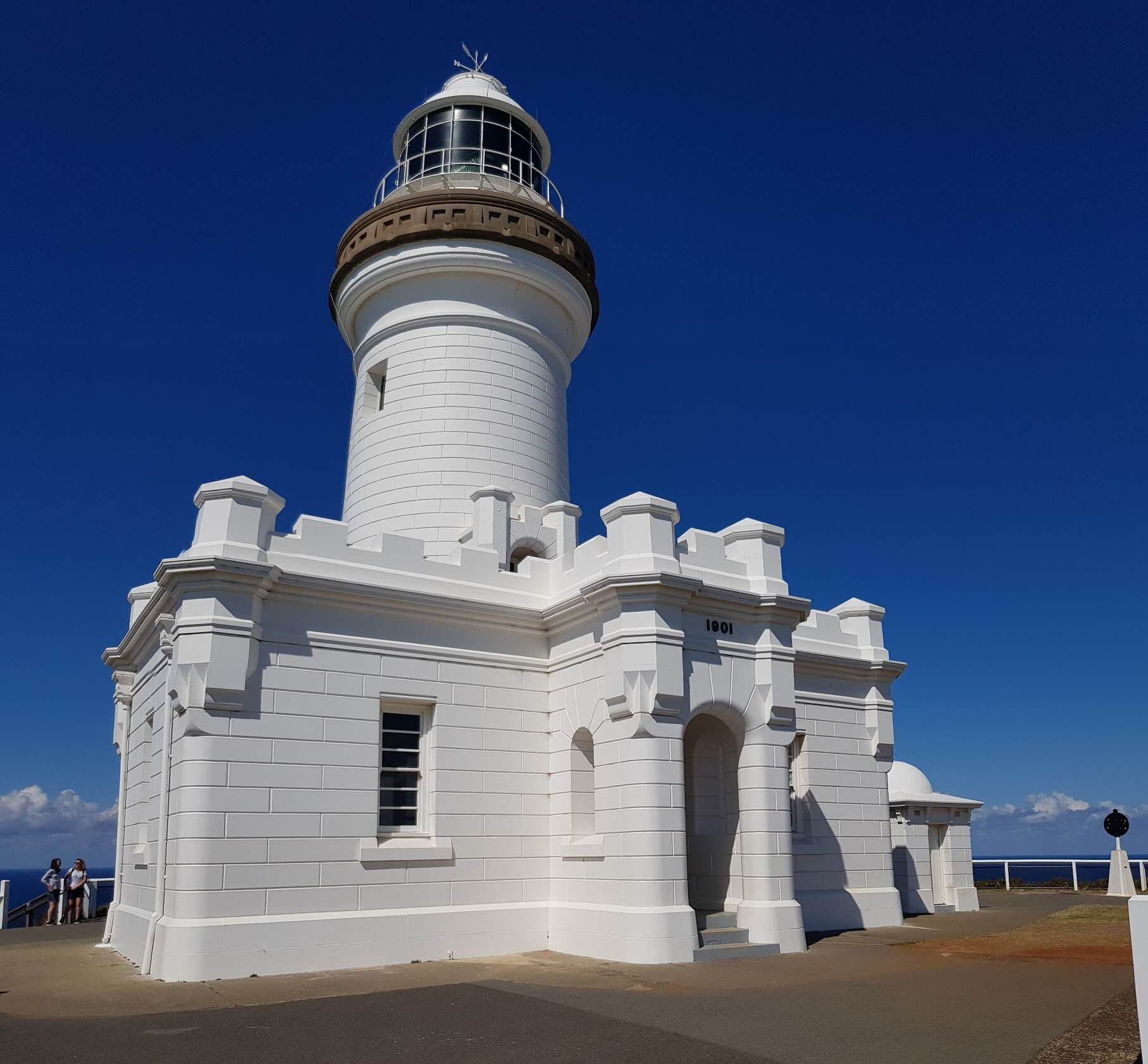
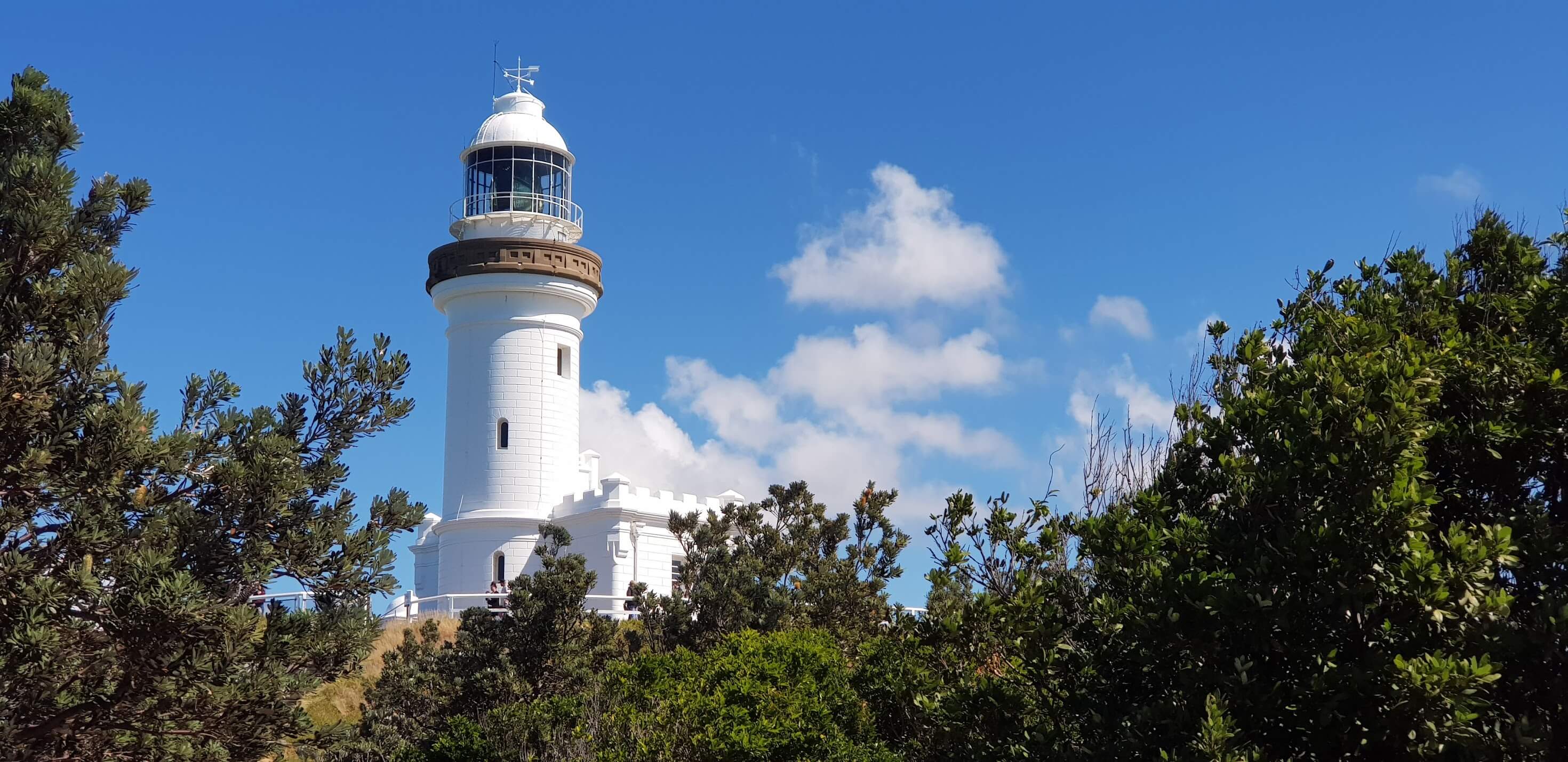
The Cape Byron headland reserve is home to the iconic Byron Bay lighthouse and is the most easterly point of the Australian mainland. This location is managed by the NSW national parks and so park fees of $8 apply for parking. Parking is also very limited right by the lighthouse, so be prepared to have to park further down the hill. Most begin the loop track from this point and walk up. The walking track of Cape Byron headland reserve takes you to several key points depending on the distance you're willing to go.
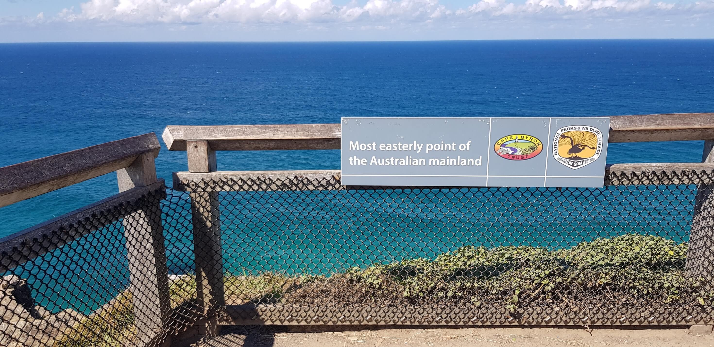
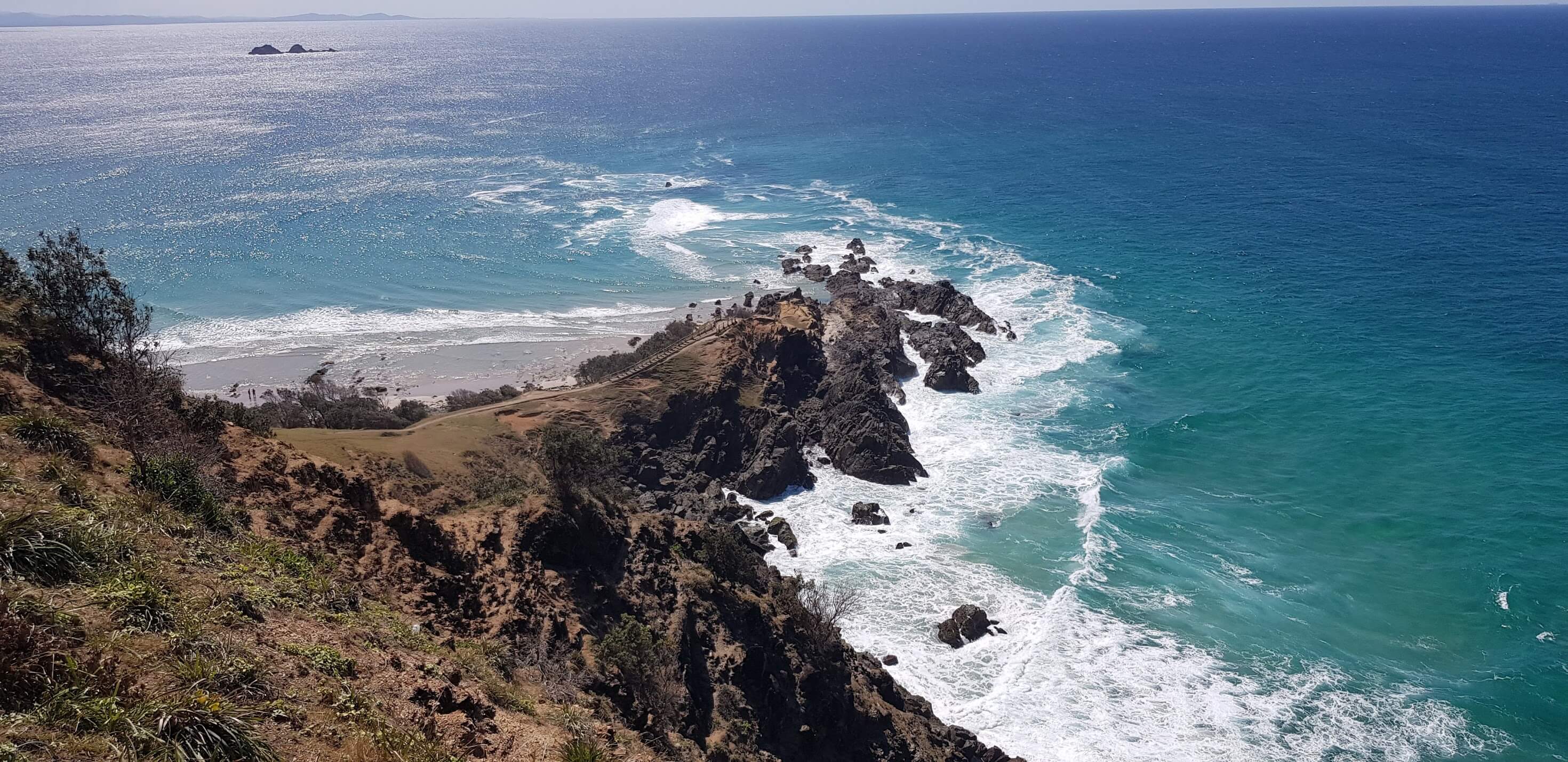
Easterly Point Lookout
This is the point to which most people will walk to. It is also the most easterly point. It is only a 300m walk from the point of the lighthouse and is a paved track. There are several lookout points along the way, overlooking the cliffs and the main stretch of beach of Byron Bay.

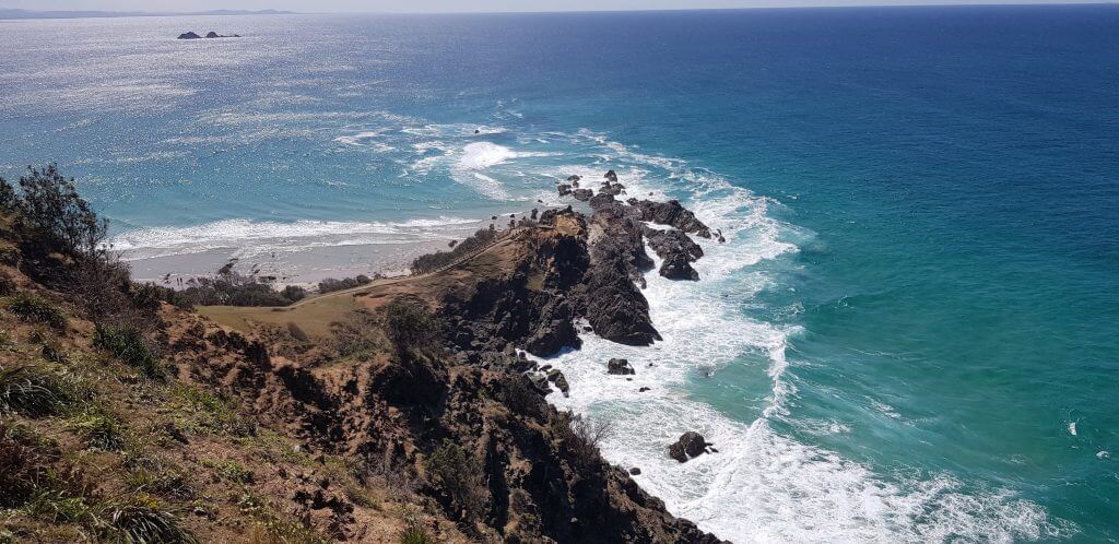
Wategos Beach
Wategos Beach and little Wategos beach are located at the very tip of the reserve, Cape Byron. You can view these beaches from the lookout point at easterly point lookout. The walk down the stairs is 400m from the easterly point lookout or 700m from the Byron Bay lighthouse.
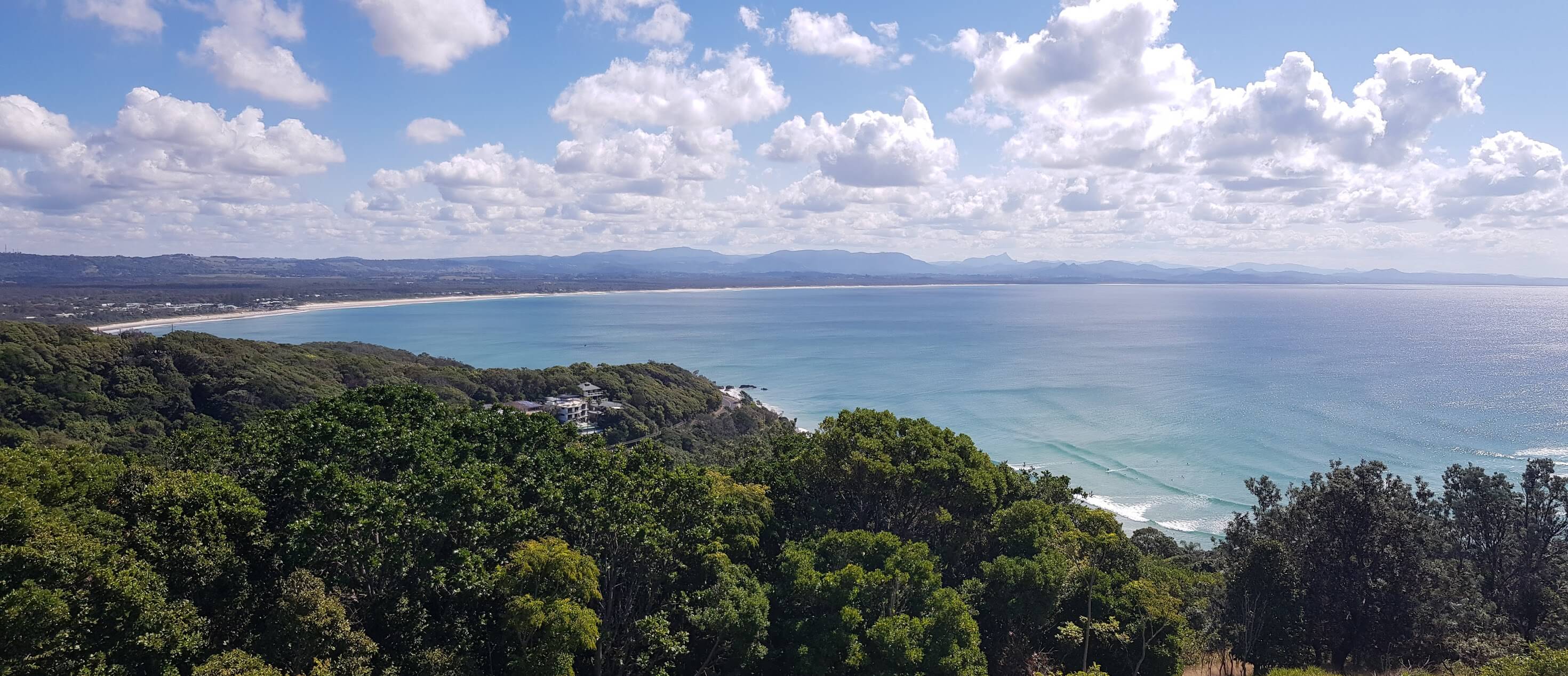
Palm Valley & Captian Cook Lookout
The reast of the walk follows by the rainforest and beaches. Just as you pass Palm Valley you will come by the Pass. Cafe Captian Cook lookout is the final point of the walk and is 2.4km from the lighthouse. The walk ends near the popular Byron Beach.

