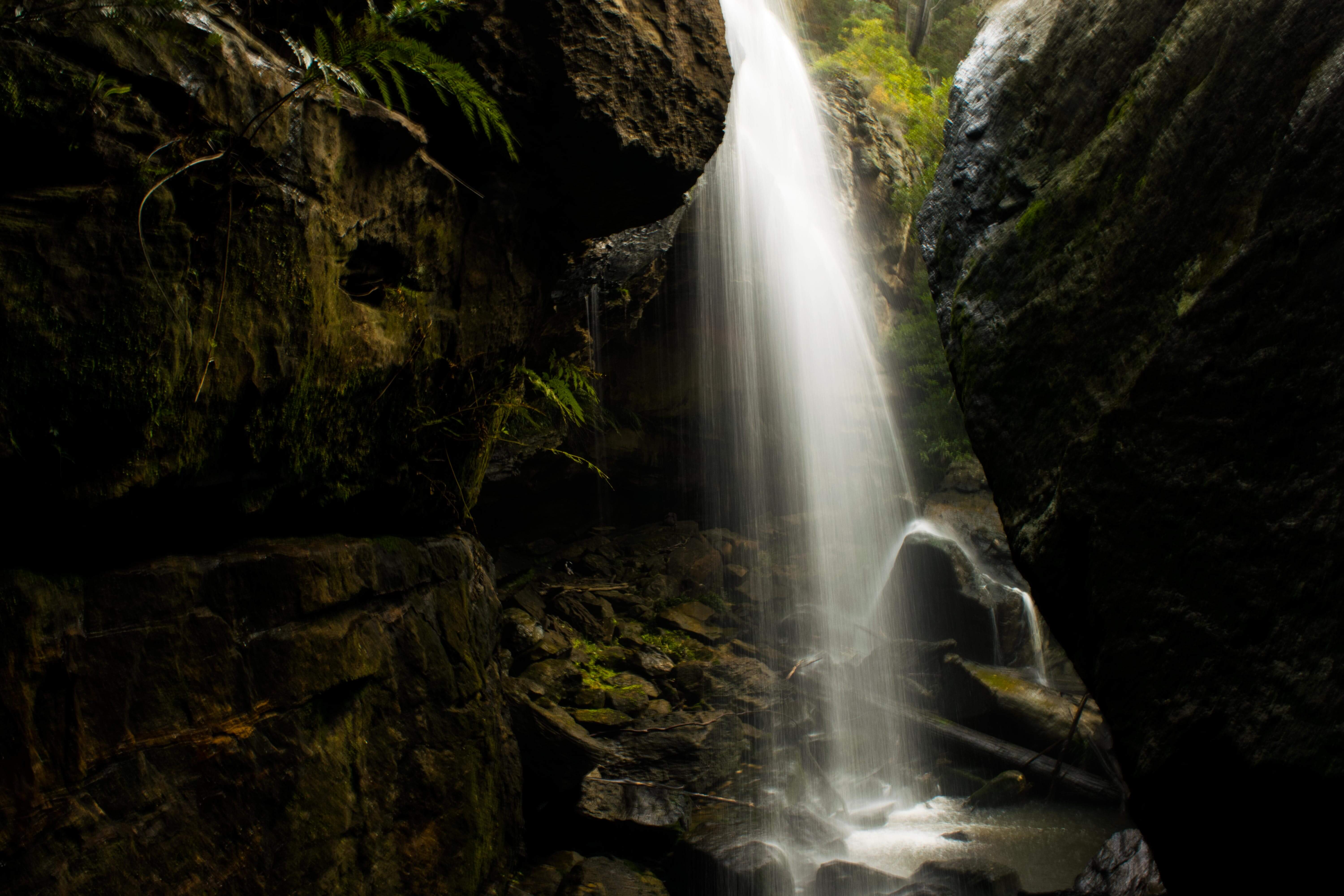





40 Foot Falls
Current trail weather
14° Overcast
- Today 16° 7° 100%
- Sat 17° 8° 89%
- Sun 18° 8° 95%
- Mon 18° 8° 95%
- Tue 21° 10° 65%
Details


Parking
Park at Lake Alexandra Reserve, Mittagong
The walk to 40-foot Falls begins at the back of lake Alexandra in Mittagong. You will see a signpost directing you to the start of the track.
Along the walk, there are signposts to help guide you, however, there are sections of the walk that are not clearly marked or allow you to take alternate routes to get to Forty Foot Falls.
The track is mostly easy but involves steep stairs, a long flight of steps, and a creek crossing. The track takes you through lush fern forest and mostly follows the creek. The final section of the walk also will require you to climb a ladder to be able to see the falls.
When you get to the falls, you may either follow the rough path down to the bottom of the falls; there is no straight forward way do to under the waterfall, so you will have to work your way down the rocks. However, getting under the waterfall is a picturesque part of the walk; you can get directly under the waterfall or explore the cavern under the waterfall if you don’t want to get wet. The other path for the waterfall takes you up some steps and then to a ladder that will take you to the top of the waterfall.
While there is no clear or defined swimming hole, there are plenty of deep pools coming up to the 40-foot falls that you may hop into to cool down should you choose to do this walk on a hot day.
Note: This is a dog-friendly walk but difficult to complete due to the stairs. Signs and posts may change, and the track may sometimes be difficult to find due to trees falling, landscape changes, and fires/floods.
Getting there
Parking
Park at Lake Alexandra Reserve, Mittagong
- Track distance
- 6.7 km
- Ascent
- 400 m
- Steepness
- Moderate (59.7 m/km)
- Descent
- 400 m
- Elevation range
- 531–638 m
Map data: © OpenStreetMap contributors, SRTM | Map style: © OpenTopoMap (CC-BY-SA) · MapLibre GL JS
Elevation profile
Community photos


Sign in to share recent conditions, contribute a photo, or upload a GPX/GeoJSON route.
 Millgrove, VIC


Your map needs some revision to show exactly where the 60 ft and 40 ft falls are.
Hi Neil,
Thank you for the feedback. Currently we pin point the starting location of our listed walks on the map, not the highlights. We will however have some improvements to our mapping system in the future to give me detail for the whole walk.
We did not find this track to be well signposted, there were many forks in the road, and I ended up using Google maps to see what direction we should be heading in to choose which way to go. We saw only 3 of the poles with the red spray-painted tips along the way, including one in a section where we thought we must have taken a wrong turn to get there – so we probably were on the right track most of the time. The final street-style sign to the falls was ambiguous, leaving us thinking we needed to cross the creek again. Hot tip, you do not need to cross the creek again!
Can you fish in the pools along there ?
Good evening. Thanks a lot! Great article
The alternate track to 40 foot falls starts at Woodlands, at Box Vale Mine Trackhead. It is a 1.8km addition to the Box Vale Track. You can just do the 40 foot falls hike, follow the Box Vale signs until you see the turnoff, it is well sign posted after that, then come back the same way.It is very steep at the end, steps & a ladder,or view the falls from the top
This was my second attempt to find the falls, however this is due to no sign post at all
I have been on walks all over the world, which are so well signed posted.
We need to do this 100% better.
We have such incredible bush to explore and its embarrassing to think that is not up too scratch for locals or visitors.
I did this walk yesterday (30/12). The creek crossing at about the halfway point was more adventurous than previous walks. I ended up crossing with the help of a log which was okay for me but I would not recommend the walk for anyone with younger children until this is fixed up. The track is also a little overgrown at the moment probably due to the rain keeping walkers away. It is a lovely walk though if you know where you are going. I just can’t understand why such a great little walk is not signposted better. Anyone wanting to do this walk for the first time will either need to go with someone who knows how to get there or use a mapping app on a mobile phone because there are four important forks you need to take that aren’t very well sign posted, if at all. In saying all of that, it is a lovely walk with really nice scenery along the way. I highly recommend.